Field campaigns generally need guidance on the expected future atmospheric conditions. For instance, airborne campaigns might want to know where a pollution plume is going to be in a couple of days to plan the flight track and request the necessary permissions to overfly the area. Ground-based studies might also need this information to better prepare for pollution episodes and setup mobile measurements. We participate in field campaigns by using air quality models in forecasting mode to provide such guidance. Our participation can involve multiple steps:
- Planing stage. It involves participating in writing the project proposal or white paper by including the planned forecast systems and help define the research questions that could be answered using the data and modeling tools.
- Preparing for the campaign. This involves configuring the model and setting scripts so it would run automatically in our high-performance computing system, preparing the plots and webpage to display results
- Field work. We as modelers also deploy in the field to provide forecasting briefings and to participate in flight planning keeping in mind the data that would be needed to answer our research questions together with the models.
- Post-campaign analysis. Includes evaluating the forecasts, perform additional simulations in analysis mode, and providing model support to members of the science team.
We participated in past and current field campaigns from multiple agencies including NASA (KORUS-AQ, ORACLES, SEAC4RS), NOAA (FIREx) and NSF (VOCALS-REx) and hope to keep participating in more to come!
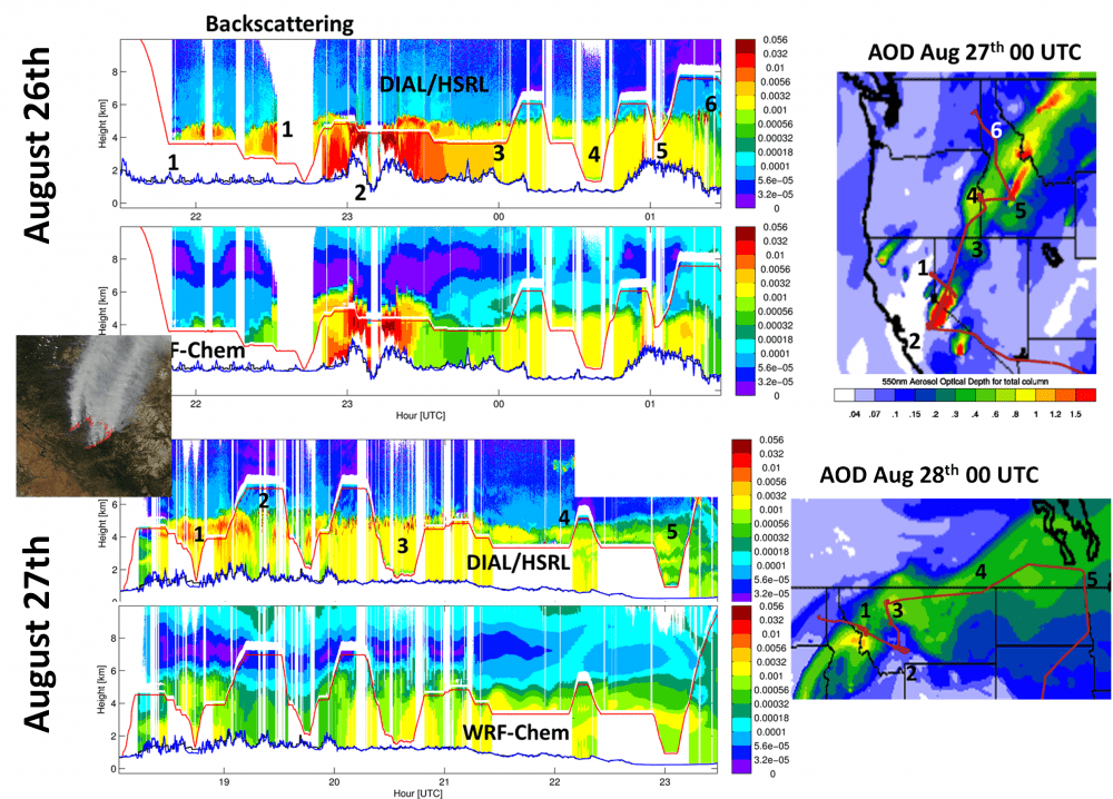
The figure below shows an example of model comparison to field data for flights that measured the Rim fire, one of the largest fires recorded in California, during the SEAC4RS field campaign. The model (WRF-Chem) is able to represent the location of the smoke as measured by an airborne lidar (DIAL/HSRL) in both flights but the magnitude of smoke concentrations can sometimes be off. See one of our GRL papers for more info on how we addressed this issue.